
Description
The Akkerweb platform has four target groups:
- The grower: Akkerweb as an effective geographical information environment supporting day-to-day farm management and as central point for information systems made available by third parties.
- The advisor: Up-to-date, GIS-based, advice can be offered via Akkerweb and its GIS applications can help to identify rapidly and efficiently the needs of the grower for each field.
- The developer: A toolbox that enables the rapid and simple development of web-based GIS applications is made available.
- The Wageningen University researcher: A platform to develop applications and to demonstrate Wageningen University knowledge (showcase of knowledge) to the outside world. In addition, Akkerweb is also intended to initiate new projects after consultation and in collaboration with agro business.
Akkerweb offers companies, cooperatives and growers’ groups the opportunity to develop and demonstrate applications on a collaborative basis, and – where appropriate – to take these into production. Development costs of applications are low as Akkerweb provides generic functionality, which is shared with all applications. A brief explanation of the functionalities offered by Akkerweb is given below, including a list of applications already available or in development.
Akkerweb Toolbox
Developers can take advantage of the Akkerweb infrastructure and services found on the platform for the rapid development of new applications. Applications visible on Akkerweb can run on Akkerbweb servers and on third party servers. Moreover, applications on Akkerweb can be visible to everyone or be exclusive for certain companies or persons.
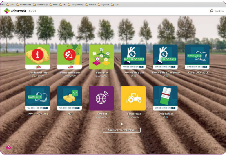
Akkerweb Applications
Applications on Akkerweb can be free for use or after license payment. Pay per ha, fee reduction using promotion codes, etc are possible. All applications on Akkerweb can exchange data with each other.
Free Akkerweb applications:
- My Cropping Plan: Entering grower’s fields (manually, own measurements, via web services
connecting to official bodies and Farm Management Systems) and adding crops. - Map: Overview of all grower’s fields on a map. Add layers of information from your applications:
e.g. all fields that have been sampled. All fields with sensor data, etc. Klick on a field and all
information available will be listed. - Sensor data: Upload all types of sensor data and visualize the information. Use these data in the
different applications on Akkerweb. - Satellite: Download satellite imagery – WDVI and NVDI biomass maps for further use in Akkerweb,
e.g. Haulmkilling. - My Advices: Advice generated in the various apps, including those of the advisory Apps, can be
found here. - Contacts: Connect with another Akkerweb user and share information in different ways (timebound,
editable or not, etc.).
Akkerweb offers the user the following standard features:
- Login: Akkerweb offers an individual login for accounts; this means that only the user (grower) has access
to the files he owns. Via ‘single sign on’ the user is directly logged onto other services and applications that
are relevant for him; this avoids repeated entering of user account credentials - Background maps: Displaying geographical information against a freely chosen background: Google
maps, OpenStreetMap, Bing, Top10 or any other background. - Geographical field information government: Can be downloaded using various web services, directly
from the government or by public reference map layers of crop fields (most EU countries). - Address details of growers/fields: Once entered, data are available in all applications the grower wishes to
use. - Downloading or drawing fields: Fields can be uploaded from Farm Management Systems CROP-r and
CropVision (upload xml message) or added using drag and drop’.’ (different formats are supported: shape
files, Google polygons, etc.). If necessary they can be drawn by hand. - Cultivation data: If not available by upload from a Farm Management Systems, Akkerweb provides a
simple crop rotation application to provide advisory systems with cropping information (crops, varieties,
planting date, growing period). - Sensor data: Tractor logs, data via .csv, .xlsx, .dbf, .dat, but also satellite data (NVDI, WDVI, yield maps
(geotiff) can be uploaded. Addition of a new format will take half a day. - Editing: Standard functionality for editing geographical information; Edit, merge or split fields, add objects,
convert grid files and other formats into visual information. - Links: Web services to collect data from external Agro partners are available, a.o. NAK, ISAcert, De Groene
Vlieg, Eurofins, Alterra, NEO,CROP-R and CropVision. - Storage: All Data remain property of the grower/owner and can be used or stored for later application.
- Output: Generic output is possible. As csv file, as pdf for pictures, etc. This functionality is available to each
application. - Applications: The grower can use the free and the commercial applications with the plot as his starting
point. - ISOBUS, shape and surfer: Task maps can be generated created for ISOBUS, shape and surfer format.
- Sharing information: Growers can share their geographical information, time-limited if necessary, completely
or partially, with third parties (neighbour, cooperation or payroll employee). - Send / Retrieve Data: Edi-Crop v 4.0 and the eLab messages are supported. Using services to business
management systems duplicate data input is prevented. - Uptime and scalability: The Akkerweb platform is hosted on Amazon servers under European law. This
ensures an uptime of almost 100%, an instant scalability (number of users) and provides the need for fast
processing of geographic data. - Weather: Available are forecasts and observed weather and rain radar information.
- Use of soil maps, crop growth models, etc.
Commercial Akkerweb applications:
- Digital sampling request: nematodes, phosphate, white rot.
- Stripbuilder: Subdivision of fields into sampling units for nematodes, phosphate, white rot, tracks, buffers,
to display results of soil sampling. - NemaDecide Geo: Free version of the decision support system for the potato cyst nematode.
- NemaDecide Geo PLUS: Extended version of NemaDecide including the root-knot nematode
(M. chitwoodi) and the root lesion nematode (Pratylenchus penetrans) and extended features. - Agrifirm Mineral: Calculate fertilizer needs, based on crop, soil type, acreage for your whole farm.
- Agrifirm Crop Protection: Calculate for all fields the need for crop protection.
- Task map nematostats: based on soil sampling results a task map will be calculated including official
delimitation. - Potato information: More than 400 potato cultivars and all their properties, including partial resistance
against potato cyst nematodes, blight, etc. including data querying and links to the breeders. - Task map haulm killing: Biomass-dependent haulm killing of potatoes based on NDVI and WDVI
originating from satellite and ebee. - Task map top dress nitrogen: Biomass-dependent task map for nitrogen top dress for potato based on
NDVI and WDVI originating from satellite and ebee. - Task map herbicides: an application map based on lutum (clay particles < 2 μm), and organic matter
content of the soil. - Get hold of your grass production: Measure your grass height georeferenced using your mobile and
calculate the Feed Wedge on Akkerweb. - Bioscope: a service that provides a farmer with different products, among which an WDVI-green biomass
map, every 10 days. Imagery is originates from satellites or from drones, when satellite images are
unavailable. - Late Blight: A completely new state of the art decision support system to avoid yield losses by
Phytophthora infestans