Description
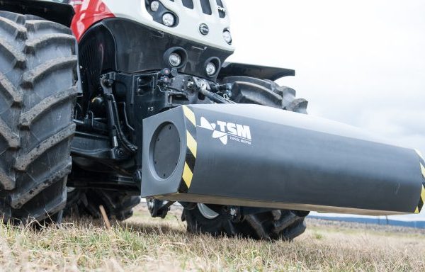
The Topsoil Mapper product set consists of the following components:
1. Topsoil Mapper (TSM)
The sensor itself is made of robust, entirely non-conductive material, can be used during each pass and is capable of recording soil data autonomously. On any towing vehicle, the TSM can be used regardless of weather and vegetation.
There are various application possibilities:
- Contact-free analysis of soil structure
In BASIC mode, the system can be mounted on any towing vehicle to conduct autonomous measurements of the soil’s electrical conductivity without contacting the soil. Maps with the soil parameters for compaction, type of soil and water saturation can be determined from the measured data.
The farmer then has the option of integrating this data with other data for their farm management system and generating application maps from the results. As a rule, farmers use these maps in combination with the site-specific control of their agricultural equipment, as well as for planning of further agricultural operations.
- Variable control of agricultural machines in real time
As an alternative to asynchronous usage, the soil information can be used in PRO mode in combination with the appropriate agricultural equipment so that the latter can be controlled flexibly in real time. This allows two processes (acquisition and application) to be combined into one work step. The TSM is the only soil sensor on the market that can be used in this manner.
When using the TSM for cultivation, the soil parameters determined by the system will be integrated into the calculation of the ideal depth of cultivation in real time. The parameters will be transferred as control parameters to the appropriate machine, while simultaneously implementing data acquisition during the soil cultivation process.
Depending on the cultivation strategy (shallow cultivation, sub soiling or contour tracking), corresponding settings can also be modified on the terminal software so that additional information about the field will be taken into consideration.
- Sensor-supported seed control in real time
The application of sensor-supported real-time control, which can be realized with the TSM, also presents a huge potential for optimization in other areas, such as seed drilling. The TSM is the first ISOBUS-capable soil sensor that can be used to control sowing machines. With this system it is for the first time possible to adapt sowing to varying site conditions (soil type, soil moisture) in real time.
NEWS:
Since 2017 the TSM version TSM ISOconnect is also available as the first ISOBUS-compatible soil sensor. The big advantage of this option is the easier handling, since this is a plug and play solution and only one terminal is necessary.
Since 2016, we have offered the option of integrating the TSM directly into the front weight. The mounting of front weight and TSM can be done in one step. In addition, the sensor is also better protected against environmental influences.
2. Topsoil Visualizer (TSV)
The role of the Topsoil Visualizer is to automatically process the recorded soil data and to calculate certain soil parameters such as compaction or water saturation. The information can then be passed directly to the implement, which automatically sets the tilling depth or controls the sowing quantity, allowing two steps to be performed simultaneously.
The new software release (TSV 2018) with revised functionalities and more intuitive applications was presented at the Agritechnica 2017.
3. Topsoil Data Box (TSDB)
Our web portal allows field-related visualisation of the soil parameters recorded, with the user being able to select different map displays. Output is also available as a geo-referenced data set for further processing in the company’s internal geo-information system.
4. Topsoil Data Analyzer (TSDA)
The Topsoil Data Analyzer is a desktop software that can be used, installed on the laptop, directly on the field. This means that the actual data collected can be transferred to the laptop immediately and be analyzed automatically. The raw data and the processed data are displayed as maps within a few seconds. Consequently, for example soil samples, can be taken immediately and directly based on the zone maps determined on site.
The benefits of the software at a glance: the data quality is immediately verifiable; work processes are significantly reduced; automated and consistent data analysis by ONE analyst (the TSDA software); independence in determining different soil parameters (relative water content, soil type and densities).


Reviews
There are no reviews yet.