farmAR – pragmatic – store

LEARN MORE

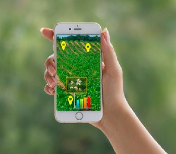
farmAR is an augmented reality app which is supported by an advanced back-end of an artificial intelligence software implemented in fully automated cloud computing system.

The cloud computing system automatically collects the latest satellite observation data of the users’ lands. The observation is processed, in order to understand important locations which need urgent attention (such as water need or start of disease). You can walk in the field with AR guidance, and reach to these important locations which we call geoTAGs or arTAGs.

Description

You can make photos, add notes, create labels and keep your own content in certain locations of the land. Later, you can visualize your own photos, notes and labels in the field with the farmAR app.

You can read your past notes with augmented reality. Just like AR post-it’s left in certain locations of the land.

You can visualize your past photos with augmented reality in the exact position where you took the picture. You can easily compare the past picture with the current situation.

In addition to that, the farmAR cloud computing platform uses artificial intelligence and deep learning to better understand satellite images of your land by analyzing your self-generated labels.

Product Enquiry

Reviews

There are no reviews yet.

Be the first to review “farmAR”

Seller Information

  • Store Name: create4D
  • Seller: create4D
  • Address: Hengelo
    Netherlands
  • No ratings found yet!


Other Categories