Description
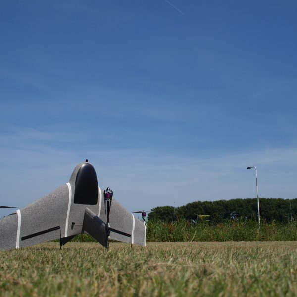
Capturing images from the sky results in the ability to cover a large area in a short time period. Multispectral cameras can detect light reflectance in the visible and invisible spectrum that can be used to determine the plant stress on an individual level. Combining Marlyn with a multispectral camera creates the opportunity to visualize the crop health from a large terrain.
Already drones are becoming the preferred aerial-support platform for farmers. Drones have a very high level of flexibility, can be deployed rapidly, have a superior resolution and are not susceptible to cloud cover. Drones therefore have a clear advantage over satellite imagery and manned aircraft surveys. To be more specific, a satellite is limited in spatial resolution, has slow image acquisition and is susceptible to cloud cover. Manned aircraft have a higher operating costs and lack flexibility.
Marlyn is fully automated. With a simple push of a button the drone lifts off and starts mapping the crops. After the flight the drone will land again vertically at the same spot it was launched. The captured data is post-processed into maps, in combination with i.e. Normalized Difference Vegetation Index (NDVI) algorithms to provide the user with actionable insights.
Precision Agriculture
- Identify problem areas in a field
- Optimize fertilization & irrigation
- Minimize pesticide usage
- Estimate & increase crop yield
Features:
- Take-off from anywhere – take-off from confined space, rocky underground or other difficult terrains ; no need to search for an appropriate location
- Belly landings belong to the past – Marlyn can land vertically on the spor where it took off
- Stop carryng around bulky catapults – no catapults, no nets, no parachutes required
- Efficient mapping – Marlyn maps 1 km² with a GSD of 3 cm/px in half an hour (0,4 mi² with a GSD of 1,2 inch/px)
- Cover more area – Marlyn maps up to 12 km² in a single flight 10x
- Maping 10x faster – than multirotors of similar class


Reviews
There are no reviews yet.