nova

Skycision delivers a data-driven software solution to agricultural operations using drones to acquire aerial imagery. Remote field sensing capabilities are leveraged in building predictive models which enable us to predict yield performance as well as prescribe precise field treatments. Growers using our platform will see decreases in costs resulting from streamlined efficiency as well as a maximization of yield potential, all of which contribute to enhanced bottom line performance.

The Precision Agriculture movement is underway and with high resolution aerial imagery, we can change the way key decisions are approached.

Aerial imagery helps speciality and commodity growers by segmenting a block into relative health zones and giving the farmer a birds eye view of all their fields at once. By accounting for field­-based inputs, weather conditions, and disease possibilities, a farmer or agronomist can determine the best inputs for each portion of the field, which can yield in substantial cost savings. Let our image processing track emergence and tally stand counts for you. An estimated 10% of row crop yield can fluctuate annually due to scouting generalizations where blight or pests in a field are missed on a given pass. Drone or Satellite imagery can be the ultimate assistant to your scouts to make sure no portion of your field goes unnoticed.

CROPS SERVICED:

  • Row crops
  • Orchards
  • Vineyards

Description

SKYCISION is here to save you time and provide you the best data to make those tough decisions, a little bit easier.

Benefits:

  • Easy to use – tap the fields you wish to fly and get back to work while our app takes care of the rest.
  • Save time scouting – manual inspection can be exaustive – Skycision automates this process to help you spend your time elswhere.
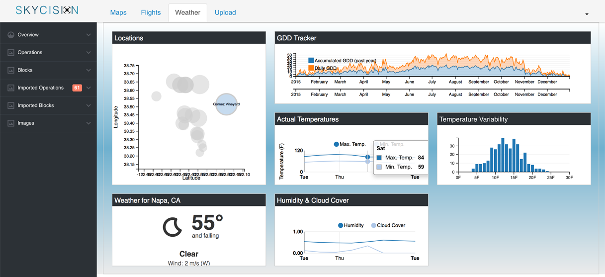
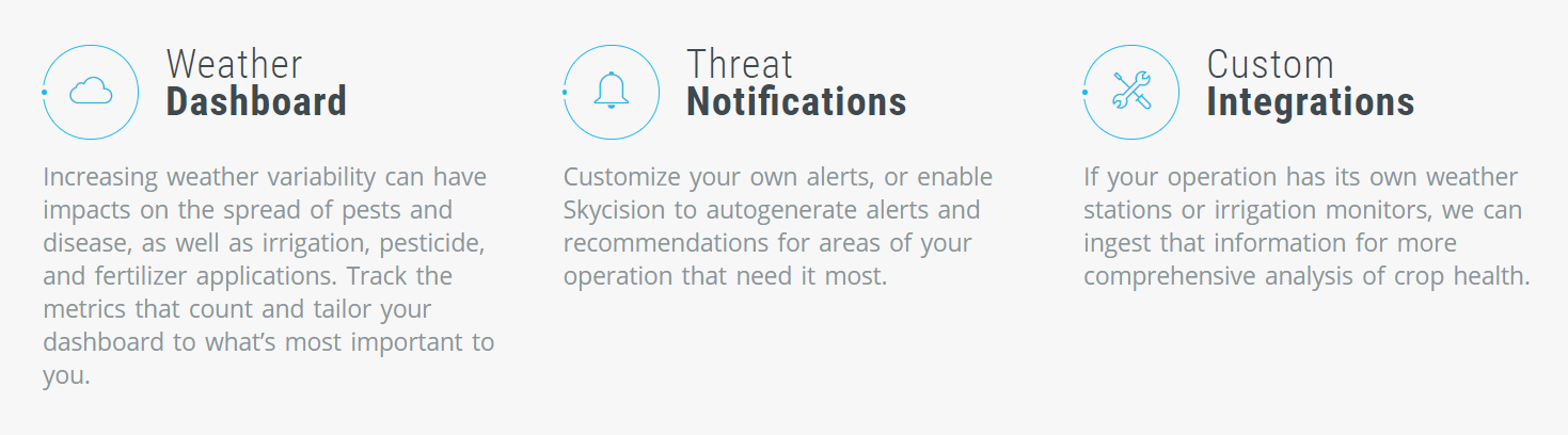
  • Detect stress sooner – we can pinpoint the effects od pests/disease or water stress before it begins to spread, enabling quicker remediation.
  • Maximize yield – we analize weather, soil and field data to help you make the best decision to optimize your yield potencial.

How it works?

1) Pick Your Drone

Our flight planning application works with DJI”s Suite of Phantoms, Inspires, or the Matrice 100 or 600 models. We guide you in selecting which drone model and camera set will work best for your operation, and deliver your vehicle fully assembled.

2) Plan Your Flights

We realize your time is precious, and it’s for that very reason we take care of the flying for you. No need to define your own flight plan, just select the field you want to fly and our application takes care of the rest. Tap to deploy and get back to work while your drone works alongside you.

3) Upload Your Imagery

Whether you’re using DJI or another manufacturer, simply upload your imagery to our portal and we’ll provide you with exportable georeferenced orthomosaics showing you the strength and weaknesses in your fields from a bird’s eye view.


Product Enquiry

Reviews

There are no reviews yet.

Be the first to review “SKYCISION – DRONE”

Seller Information

  • Store Name: SKYCISION
  • Seller: Eric Belleville
  • Address: Capitola, CA
    United States (US)
  • No ratings found yet!


Other Categories