Description
Crop Monitoring
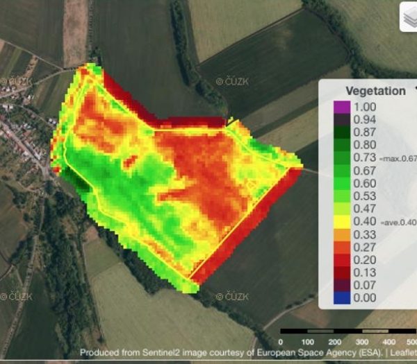
Remote monitoring of crop conditions using Copernicus programme satellite data. Chlorophyll, biomass, water stress and yield forecast as monitored biophysical parameters. You get an inside of how your crops on the fields are developing without actually going there.
Farm management zone determination
Analysing long time series of Landsat and SPOT images, CleverFarm provides determination of farm management zones of your plots for individual crops with a focus on the problematic areas. The result is then splitting the parcel into usually three performance categories
and determining the yield potential on the fields.
Simple optimization of fertilization
Satellites continually monitor and acquire images for determination of vegetation health and biomass development on your land. Within Sentinel module, you can easily create variable application map selecting suitable scenario for your plots. Using a USB disk, you can load the
fertiliser maps into your on-board computer of you machinery. The instruments then automatically dispense the fertiliser according to the set zones.
Curent pictures and history always available
Using our application, you have an access to current images of your farm and plots and to a complete image history several years back.
Variable-rate seeding and variable spraying are under preparation
Satellite data technology does not end with only variable fertilization. During the 2019 season, we are preparing Sentinel for use with variable-rate seeding and the variable- rate application of plant protection products.


Reviews
There are no reviews yet.