Description
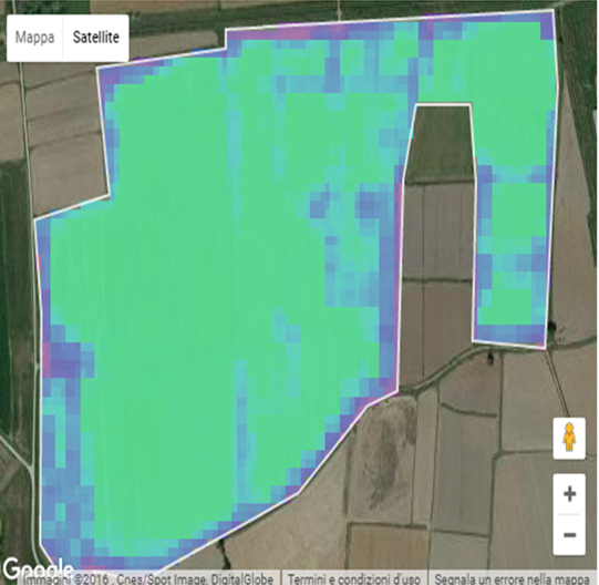
OMICAFARM® – OBSERVE allows farmers to monitor the growth of their crops through analysis of satellite imagery. Farmer can control extended areas with no limitations, worldwide. Satellite imagery are automatically download and analysed with a periodicity up to 5 days. Results of this complex analysis are provided as geo-referenced maps, available on the personal account. Farmers can get many useful information about crop biomass, water stress, yield prediction and their spatial distribution over the field.
Satellite crop monitoring helps farmers to understand where, when and how to intervene thanks to georeferenced maps. These data are crucial to implement “zone management” strategies intervening only where necessary. OMICAFARM® is the ideal support for implementing intelligent crop strategies such as “Precision Irrigation” and “Precision Fertilization“. You can also check, in few days, the effectiveness of your actions having a feedback of the expected benefits.
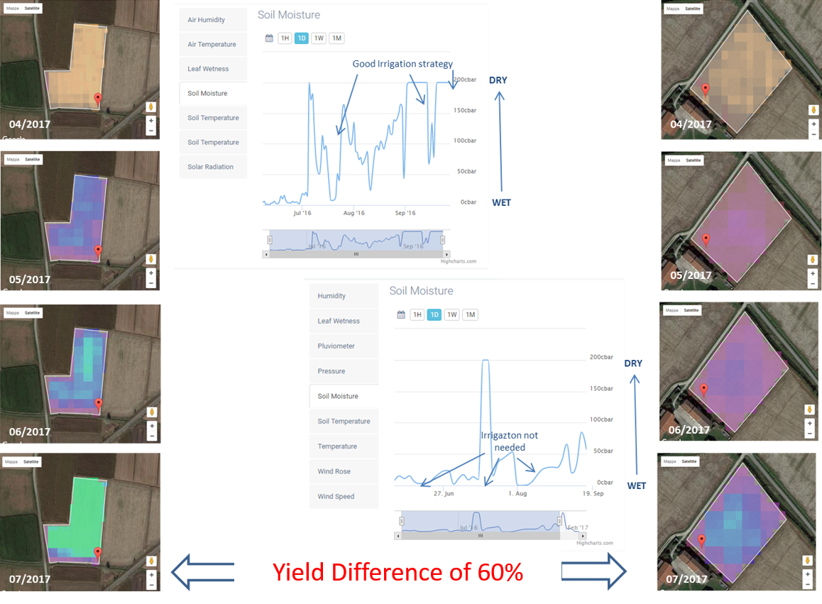
Application for Smart Irrigation or Precise Irrigation
OMICAFARM® SENSE&OBSERVE is a service that enables farmers to:
– Measure the soil moisture and other environmental parameters at certain points within his field using OMICAFARM® Monitoring Stations (AGRO-WEATHER, AGRO-BASIC, AGRO-SUN)
– Observe the spatial distribution of water stress over the whole field
– Decide on the basis of measureable parameters!
An optimized irrigation strategy can improve the crop yield of a factor from 20% up to 50%.
Application for Smart Fertilization or Precise Fertilization
OMICAFARM® SENSE&OBSERVE is a service that enables farmers to:
– Measure agro-environmental parameters with OMICAFARM® Monitoring Stations (AGRO-WEATHER, AGRO-BASIC, AGRO-SUN)
– Observe the crop growth in each point of the field since the first stage
– Evaluate and promptly intervene in case crop growth deficit are identified
– Decide on the basis of measurable parameters!
An optimized fertilization strategy can improve the crop yield of a factor up to 20% reducing costs and improving environmental sustainability.
Application for Smart Planning
Upon request can be elaborated maps related to:
– Dry fraction
– Bare soil water content
– Bare soil carbon content content
– Bare soil electrical conductibility.
This type of analysis is very useful for planning precision fertilization strategy before the season starting. Pre-sowing analysis allows, as example, to identify zones, within the same filed with greater risk of water stagnation, or zones that needs a greater fertilization.
Post-harvest analysis allows to evaluate the carbon content left on-the-fields. This impact the fertility of the field and the yield of the next crop.
All this analysis can be performed on historical data up to 5-10 years (ask for info)
For further information, price policy for multiple purchase, contact us.


Reviews
There are no reviews yet.